
I stopped to catch my breath, which on this part of the climb meant catching quite a lot of it. The ground fell away in front of us, further than I wanted to measure. To my left the trail kept climbing; to my right the group came up behind me, one by one, breathing hard. I waited for everyone to gather, asked for a smile, and got one out of most of them — which, given what we’d just climbed, I thought was generous. Then I took the photo.

We’d driven 75km out of Centurion, stopping for a fancy coffee on the way — something we do most times we head out of the city for a hike. I’d collected a fellow hike leader; the rest we’d meet at the farm. The last 3.5km to the farm is dirt road, the kind that slows you down and tells you you’ve left the city behind properly now. 10 of us, eventually — 2 ran late, so we stood around in the early light longer than planned, which nobody minded.
Some of the group knew this trail. For the new ones, the briefing did the work: a 476-metre climb that would test them, mentally as much as physically. They nodded the way people nod when they haven’t felt it yet.
Then we came out from under the trees by the reception area, and the south face of the Magaliesberg was just there in the morning light. I stopped. I’d seen it before. I stopped anyway.
From the trailhead it climbed gently, and the first stretch was honestly the nicest part — most of it under trees, close in against the mountain, cool enough that you forgot what was coming. There’s an olive tree along here said to be 1000 years old, and a little further on the ruins of an Iron Age village. “Ruins” is generous — big rocks stacked against each other, more idea than structure. You’d walk past it if nobody told you.
Then the trail brought us to Shelter Rock itself, a great sandstone boulder that broke off the cliff face thousands of years ago and rolled down to form a deep overhang. We stopped here a while. A few of the group scrambled up it for photos and seemed in no hurry to come down. There are QR codes posted at the points of interest along the trail — scan one and it tells you what happened there. This one earns it: the women of the area sheltered under this rock from the English during the Anglo-Boer War. You stand under the overhang and it’s not hard to picture.
From Shelter Rock the trail changed its mind about us. The gradient steepened, the path turned to loose rock and then large rock — less walking than climbing, like going up huge uneven stairs built by someone who didn’t care about your knees. The last 500 metres was the real work: 3 ladders, and a final pitch close to 45 degrees, with a steel cable strung along the edge — there to keep you on the mountain rather than off it.
The group went quiet. There’s a point on a climb like this where the chatting just stops — not because anyone decides to, but because the body needs everything it’s got, and talking is the first thing to go. Boots on rock. Heavy breathing. Mine included. I climbed in short bursts, maybe 10 metres at a time, then waited for everyone to gather before pushing on. 10 metres, regroup, 10 more. The last 50 metres bit hardest — steep enough that you stopped thinking about the view and started thinking about the next handhold.
Then the fort. There’s an Anglo-Boer War fort at the top, and that’s where we caught our breath and I took the group photo — 9 of them grinning at the camera, slightly wrecked, all of them having earned it.
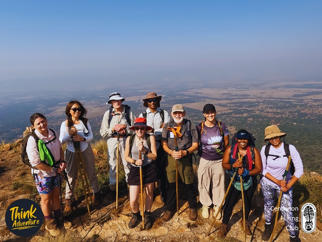
And then you’re at the top, and you stop needing to be told why you came.
The whole south side of the Magaliesberg opens up below you, farmland running out flat and hazy as far as you can see — divided into squares, the way it only looks from up high, fields and boundaries laid out like someone had been tidying. We could pick out the farm we’d started from that morning, small now, and a dozen others past it.
Everyone went looking for a rock to sit on. Packs came off, lunch came out, and the group sorted itself the way groups do — some clustering together, sharing whatever they’d brought, others drifting a few metres off to take it in alone. Nobody was in a hurry.
The trail carries on another 1–2km from here, out to where you can see the Hartbeespoort Dam in the distance. A few of the group had had enough climbing and said they’d happily wait behind while the rest of us walked out to it. I talked it over with my fellow hike leader, and we decided we’d stay put and eat together. I don’t like breaking up a group — we’d come up together, we’d sit here together. This was good enough. More than.
It was late May, cold but not the deep cold of midwinter, and for once the mountain left us alone — no wind, no glare, just the view and the quiet after all that climbing noise had stopped. Best lunch spot I’d had in a long time. It wasn’t close.

So — should you do this one?
If you’re after a gentle wander under the trees, this isn’t it. The first stretch will fool you, but the trail is going up, and it means it. You want to be properly fit for this — not “I walk the dog” fit, but comfortable with your heart working hard for the better part of an hour. There are 3 ladders and a final pitch close to 45 degrees, with a cable strung along the edge. You don’t need any climbing skill for it — just a decent level of fitness and a head that’s okay with heights, because a real problem with exposure will take the shine off the best part of the day.
It will challenge you. That’s the point. I like the trails that make you earn the top and then hand you a view that makes the earning feel cheap by comparison — and this is one of them. Nothing went sideways for us; if anything it played out better than it had any right to. Good group, good weather, and a payoff at the top that none of the new hikers had quite believed was coming.
Would I go back? Yes. This is my kind of trail — high, hard, and worth every metre.
Practical Guide — Shelter Rock Hiking Trail
The Basics
- Trail: The Mountain Trail, Shelter Rock
- Location: Hartbeesfontein, Hekpoort — southern slopes of the Magaliesberg
- Distance: 8.4km, out-and-back (4.2km up, same way down)
- Elevation gain: 476m
- Time: Around 4 hours total, including stops and lunch at the top
- Difficulty: Moderate to Hard, depending on your fitness level
- Best time of year: Year-round. Autumn and winter (April–August) are the easy seasons — we hiked it late May, cold but not bitter, no wind, no glare. Summer is fine too, just hot: more effort, more sweat, and you’re fully exposed at the top with no shade. Whenever you go, bring suntan lotion.
- Shelters Rock on Strava
Getting There
- Roughly 75km from Centurion; the last 3.5km to the farm is dirt road, manageable in a normal car taken slowly.
- Park at Shelter Rock Base Camp, where the trail starts.
- Shelter Rock on Google Maps
The Trail Itself
- Surface: Easy, gradual and shaded through the trees for the first section, turning to loose rock and then large rock higher up. The final stretch is more scramble than walk — like climbing big, uneven steps.
- Technical sections: 3 ladders and a final pitch close to 45 degrees near the top, with a steel cable strung along the edge to hold the line. No climbing skill needed, but you’ll use your hands.
- Waymarking: Easy to follow. QR codes are posted at the points of interest along the route — scan them for the history of each spot.
- Landmarks along the way: A 1000-year-old olive tree, the ruins of an Iron Age village, Shelter Rock itself (the sandstone overhang where the women of the area sheltered from the English during the Anglo-Boer War), and an Anglo-Boer War fort at the top.
- The payoff: A viewpoint near the summit looking out over the entire south face of the Magaliesberg — farmland to the horizon. The trail continues another 1–2km to a point where you can see the Hartbeespoort Dam in the distance.
What to Bring
- Footwear: Proper hiking boots with grip — non-negotiable on the loose rock.
- Water: There are no water sources on the trail. Carry your own, at least 1.5–2 litres.
- Other: Suntan lotion and a hat — you’re exposed at the top. A snack or lunch for the summit, and a hiking pole helps on the descent over loose rock. Hands-free is best for the ladders, so a backpack beats a shoulder bag.
Safety & Logistics
- Cell signal: Good the whole way — tracked to the summit and back without dropping.
- Water sources: None. See above.
- Wildlife: We saw none. That said, this is the Magaliesberg, so on a warm day stay alert for snakes sunning themselves on the rocks — watch where you put your hands on the scramble sections.
- Emergency contact / nearest help: The farm is owner-run; Corry (below) is your first point of contact on site. Nearest towns for medical help are Magaliesburg and Hartbeespoort.
Cost & Booking
- Cost: R100 per person, payable on arrival directly to the venue (correct at time of writing, June 2026).
- Booking: It’s a small, owner-run farm with limited daily capacity, so message ahead to check availability rather than just turning up.
- Contact: Corry – 071 473 6298 (WhatsApp) – shelterrock.co.za
The Verdict
Moderate to Hard, and worth every metre. Come fit, come with a head for heights, and come for the view — not the stroll. If you want an honest test with a genuine payoff, this is one of the best near Joburg and Pretoria.
Frequently Asked Questions – Shelter Rock Hiking Trail
How much does it cost to hike the Shelter Rock Hiking Trail?
The entrance fee for the primary Mountain Trail is R100 per adult and R50 for scholars and children under 12, while kids under 6 enter for free. This rate applies to weekends and public holidays, and includes complete access to the tranquil on-site stone labyrinth, picnic sites, and base camp braai facilities.
How long and difficult is the Shelter Rock Hiking Trail?
The main Mountain Trail is an 8-kilometre circular route that features a 400-meter elevation gain to the summit of the Magaliesberg ridge. It is rated as a moderate but physically demanding hike that takes approximately 4 to 5 hours to complete due to steep, loose, and slippery terrain.
Can I bring my dog to Shelter Rock Hiking Trail?
No, pets are strictly prohibited at Shelter Rock to protect the resident wildlife and preserve the tranquil environment of the nature conservancy. The estate enforces a low-noise policy and limits overall guest capacity to prevent disturbing local species like baboons, dassies, and nesting raptors.
Do I need to book in advance for Shelter Rock?
Weekend and public holiday day hikes do not require pre-booking and accept card, cash, or EFT payments at the base camp reception on arrival. However, if you plan to visit on a weekday, you must contact the owners and submit your payment in advance to secure access to the property.
What are the opening hours for Shelter Rock Hiking Trail?
The reserve gates open daily at 07:00 AM and close promptly at 17:00 PM throughout the year. To avoid the extreme midday heat of the Magaliesberg and ensure enough time to safely complete the 5-hour trek before dark, all hikers must commence their ascent before 12:00 PM.