This caught me by surprise. I have been driving past the trailhead of this hiking trail for years and never knew it was there.
On the opposite side of the trail lies the Wonderboom Nature Reserve. You know, the one with the Wonderboom that is over 1,000 years old. Now you should have a better idea of where I am.
This morning, we are at the Friends of Magalies Hiking Trails, which runs along the Magalies Mountain Range. It appears to be the same trail as the Magalies MTB & Hiking Trail. The trailhead is just further down.
The Friends of Magalies Hiking Trail trailhead starts next to what is known as the Wonderboom Lapa. It’s right next to the Wonderboom High School. Who knew. I didn’t.
We are here to hike the trail with the Centurion Hiking Club members, but before we do that, let’s look at some history.
History
The Magaliesberg Mountain Range has a geological history of about 2.3 billion years, making it one of the oldest ranges on Earth. Its distinctive landscape is shaped by its unique composition of quartzites, shales, and dolomite.
The Magaliesberg holds geological and historical significance, linking to the “Cradle of Humankind” with vital fossil finds that shed light on human evolution. It features evidence of early ancestors and later occupants, like the San people. Additionally, it witnessed key historical events, including the Mfecane and Anglo-Boer Wars, and is named after the Tswana chief, Kgosi Mogale.
The Magaliesberg combines natural and cultural heritage with a growing tourism industry. Conservation is vital for protecting this unique area, where geological formations intersect with human history. The shift from agriculture to a site for nature enthusiasts emphasises the need to preserve its distinct features.
About
The Magaliesberg Mountain range stretches from the Pilanesberg Nature Reserve down to Rustenburg, where it curves towards Hartbeespoort past Pretoria and ends in Bronkhorspruit.
Friends of Magalies aims to preserve, manage, and protect the area between Wonderboom High School and the N1 Highway.
That being said, you can help them by becoming a member. For more details on becoming a member and its benefits, you can visit Friends of Magalies
Now back to the trail…
The Start
The trailhead parking is situated next to the Wonderboom Lapa. Hiking the trail is free. We were 20 hikers ready to explore the area. Our hiking leader shared the plan, and on we went.

Along The Trail
According to my AllTrails Map, the trail is 5.75 km with an elevation gain of 149 meters, and it took us 2 hours to complete. We were back at the trailhead/parking lot just before 11 AM.
Now, consider these figures as estimates because there were some technical difficulties with my AllTrails Map tracking. My mobile rebooted on its own without my knowledge, and sometimes the app stops recording…🤔
Maybe it’s time for an upgrade and a new tracking app.
It’s probably closer to 8 km overall on the trail. I understand the trail can continue for another 4 km until you reach the reservoir, before you need to turn around and come back.
We turned around at the point where the Magalies MTB & Hiking Trails begin on Google Maps. This appears to be another access point to the trail.
The trail was mostly open and somewhat shaded on our way back.
There is not much water along the trail except for what looked like a natural watering hole that, according to a hiker familiar with the area, fills up after some good rain. All natural.

We did not encounter any wildlife aside from birds. However, we came across two friendly horses on our way back. Luckily, I had an apple with me, which I gave to one of the horses, resulting in some great pictures.

There was also a rock formation at the top, which I was told is used for religious ceremonies. The positive kind.

The trail is well-maintained overall. The walkways are open, and I don’t recall seeing any rubbish. Well done to Friends of Magalies for taking good care of the area.
It was a cloudy morning, and the hike required little effort. Feedback from my fellow hikers was positive.
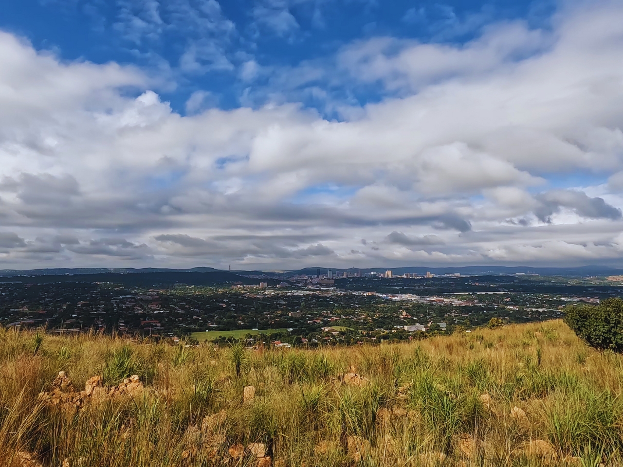
The highlight of the hike will be the elevated viewpoints of Pretoria North and the inner city, as well as spending time with those horses, which appear to be well cared for.
This trail is suitable for pets. One of the hikers had their dogs with them, and they appeared to be enjoying the outing.

They also allow mountain bikes. However, we did not see any mountain bikers during our visit.
Last Thoughts
There is nothing out there. If you’re interested in a fancy coffee and croissants afterwards, you’ll have to head out to Wonderboom Junction. There are a variety of options to please your palate.
My overall experience of the trail was positive. I will be back to hike to the reservoir or N1 if the trail goes that far. It was a morning spent with good people, nature, and exercise, which is a win in my book.
I can’t think of anything I dislike about the trail.
That’s it from me on the Friends of Magalies Hiking Trails Review. I hope you have a better idea of what to expect and that it inspires you to go and hike the trail.
Some Helpful Links
